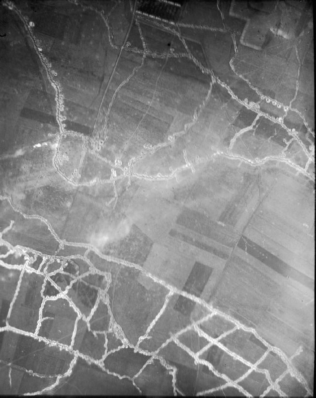

Hohenzollern Redoubt aerial photograph 1915 North at top
Aerial photograph of the Hohenzollern redoubt, near Auchy-les-Mines, France. German lines are across the top right, the Hohenzollern Redoubt is the tip of the salient protruding southwest; British lines are across botton left. NOTE: The original photograph has North at bottom. This version has been rotated 180° to place North approximately at top to facilitate comparison with maps.
- Date
- 1915-09-21
- Photographer / author
- British Government (Air force)
- Archive
- Wikimedia Commons
- Type
- photograph
- Original size
- 1,034 × 1,300 pixels
Public domain
Reason: Public domain.
This status rests on the photo's publication history, as researched by Wikimedia Commons. Check it before commercial use.
Read from: Commons licence category: Public domain; no CC BY, CC BY-SA, GFDL or deletion tag on the file page.
Credit line
"Hohenzollern Redoubt aerial photograph 1915 North at top" (1915-09-21). British Government (Air force), via Wikimedia Commons. Public domain. https://commons.wikimedia.org/wiki/File:Hohenzollern_Redoubt_aerial_photograph_1915_North_at_top.jpgNeed photos for a whole script? Add Find Any Photo to Claude and ask for this one by its id: 2733.
More like this

Aerial view Loos-Hulluch trench system July 1917
1917-07-22 · Wikimedia Commons

Schwaben Redoubt aerial photograph 10-05-1916 IWM HU 91107
1916-05-10 · Wikimedia Commons

Aerial photograph of Hindenburg Line west of Wancourt 24-03-1917 IWM
1917-03-24 · Wikimedia Commons

Aerial photograph of Thiepval bombardment 25-09-1916 IWM Q 63740
1916-09-25 · Wikimedia Commons

WW1 Aerial photograph - Messines 1917-06-02
1917-06-02 · Wikimedia Commons

Thiepval aerial photograph 01-06-1916 IWM HU 91108
1916-06-01 · Wikimedia Commons

WW1 Aerial photograph - Messines 1917-06-05
1917-06-05 · Wikimedia Commons

Aerial photograph of WW1 trenches 01
1919 · Wikimedia Commons