
LakeVistaWPAReliefMap
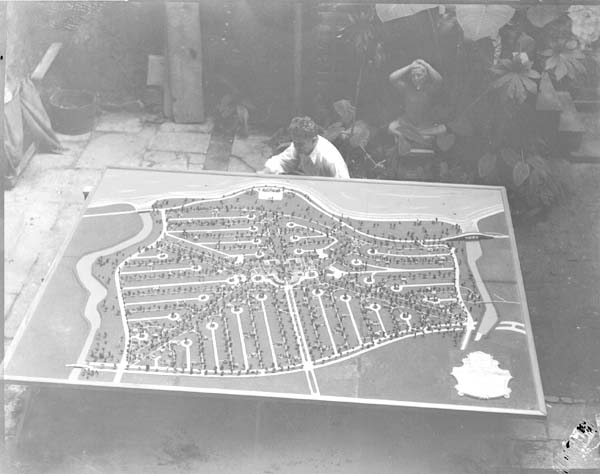
New Orleans, 1936: "The Lakefront Development, carried on by the WPA under Levee Board sponsorship, will look like this map-relief model when completed." Shows man looking over a diorama of the Lake Vista neighborhood.
- Date
- 1936-08-12
- Photographer / author
- Uncredited WPA photographer
- Archive
- Wikimedia Commons
- Type
- map
- Original size
- 600 × 474 pixels
Public domainsafest
Reason: a US government work (Works Progress Administration).
Read from: Commons licence category: PD US WPA; no CC BY, CC BY-SA, GFDL or deletion tag on the file page.
Credit line
"LakeVistaWPAReliefMap" (1936-08-12). Uncredited WPA photographer, via Wikimedia Commons. Public domain. https://commons.wikimedia.org/wiki/File:LakeVistaWPAReliefMap.jpgNeed photos for a whole script? Add Find Any Photo to Claude and ask for this one by its id: 168292.
More like this

LakefrontGreatWhiteWayOpening1937
1937-07-22 · Wikimedia Commons

CanalBlvdNOLAWPASunkenGardens 3
1940-01-09 · Wikimedia Commons

WPA Project Tour, Earl K. Long, Mayor Maestri, et al New Orleans 1936
1936-09-18 · Wikimedia Commons

CanalBlvdNOLAWPASunkenGardens1941 1
1940-01-09 · Wikimedia Commons

CanalBvdNOLAWPASunkenGardens1940 2
1940-01-09 · Wikimedia Commons

Popps Fountain City Park New Orleans 1936 WPA 116
1936-08-12 · Wikimedia Commons

$3,000,000 map. C.E. Kowaloczyk, AAA worker, laying out the finished photographs for the map, after beign correctly fitted they are pieced together for the completed map, 7/28/37
1937 · Library of Congress

Washington Airport buildings to allow full vision over 750 acre landing field. Washington, D.C., Dec. 2. The model here being inspected by Col. Sumpter Smith, Chairman of the Washington National Airport Commission, shows a portion of the field as it will look upon completion. It shows the buildings
1939 · Library of Congress