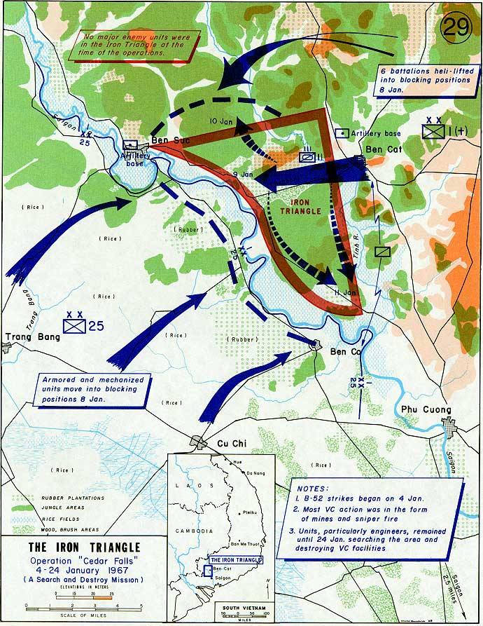

Operation Cedar Falls map
Map of operation Cedar Falls, Viet-Nam War, january 1967.
- Date
- 2012
- Photographer / author
- Department of the Army
- Archive
- Wikimedia Commons
- Type
- map
- Original size
- 690 × 893 pixels
Public domainsafest
Reason: a US government work (US Army).
Read from: Commons licence category: PD US Army; no CC BY, CC BY-SA, GFDL or deletion tag on the file page.
Credit line
"Operation Cedar Falls map" (2012). Department of the Army, via Wikimedia Commons. Public domain. https://commons.wikimedia.org/wiki/File:Operation_Cedar_Falls_map.jpgNeed photos for a whole script? Add Find Any Photo to Claude and ask for this one by its id: 2390.
More like this

Troop B, 3rd Squadron, 4th Cavalry M48A3 during Operation Cedar Falls
1967-01-17 · Wikimedia Commons

Medcap in Phu Hoa Dong village during Operation Cedar Falls
1967-01-26 · Wikimedia Commons

A Vietnamese girl is treated during Operation Cedar Falls
1967-01-26 · Wikimedia Commons

Chinese Third Phase Campaign map
1990 · Wikimedia Commons

Aerial-herbicide-spray-missions-in-Southern-Vietnam--1965-1971
1965 · Wikimedia Commons

Combat Search and Rescue map of Southeast Asia, March 1966-October 1967 (230112-F-IO108-001)
1966–1967 · Wikimedia Commons

VC prisoners, Operation Cedar Falls, 19 January 1967
1967-01-19 · Wikimedia Commons

US infantry guard VC prisoners, Operation Cedar Falls, 19 January 1967
1967-01-19 · Wikimedia Commons