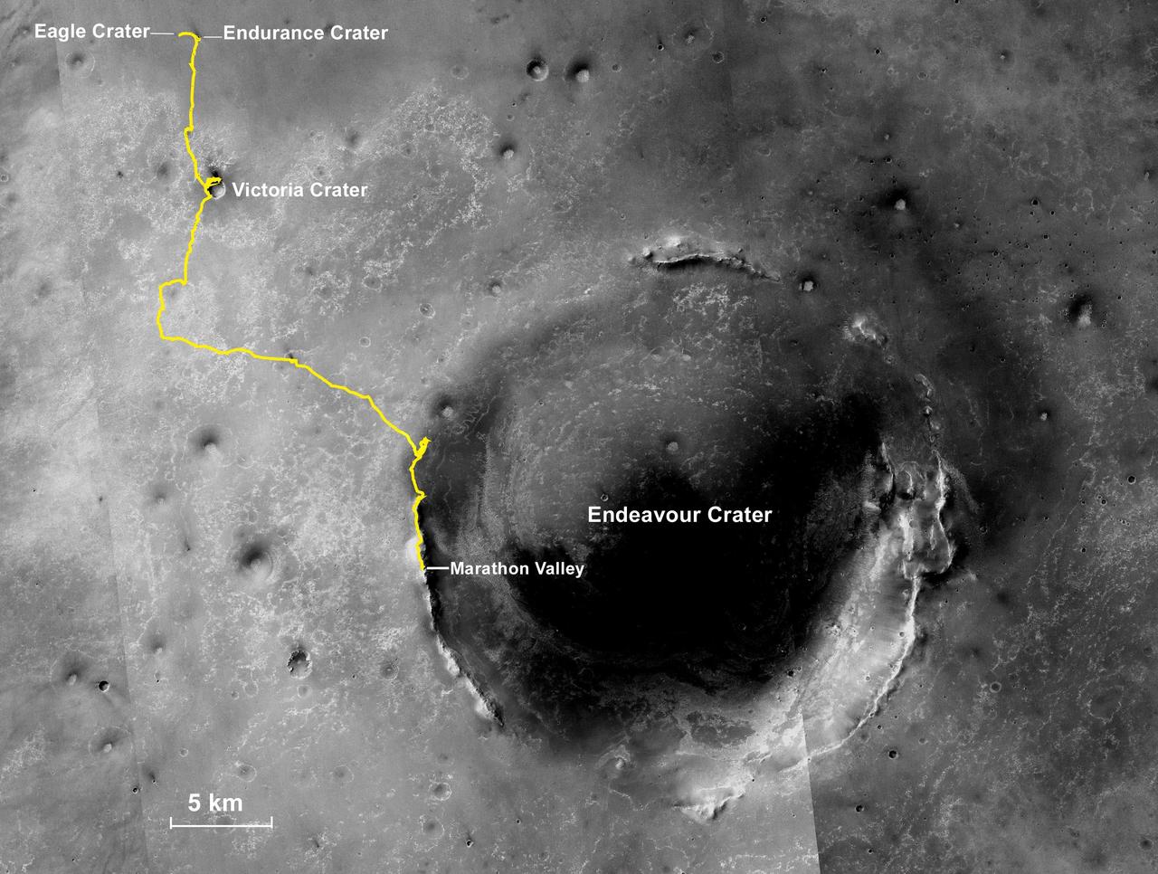
Opportunity Rover Full Marathon-Length Traverse
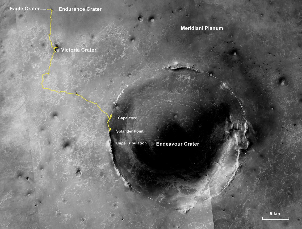
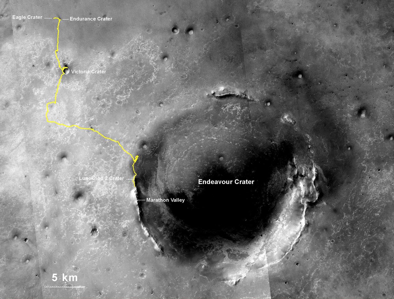
NASA's Mars Exploration Rover Opportunity, working on Mars since January 2004, passed marathon distance in total driving on March 24, 2015, during the mission's 3,968th Martian day, or sol. A drive of 153 feet (46.5 meters) on Sol 3968 brought Opportunity's total odometry to 26.221 miles (42.198 kilometers). Olympic marathon distance is 26.219 miles (42.195 kilometers). The gold line on this image shows Opportunity's route from the landing site inside Eagle Crater, in upper left, to its location after the Sol 3968 drive. The mission has been investigating on the western rim of Endeavour Crater since August 2011. This crater spans about 14 miles (22 kilometers) in diameter. The mapped area is all within the Meridiani Planum region of equatorial Mars, which was chosen as Opportunity's landing area because of earlier detection of the mineral hematite from orbit. North is up. The base image for the map is a mosaic of images taken by the Context Camera on NASA's Mars Reconnaissance Orbiter. http://photojournal.jpl.nasa.gov/catalog/PIA19154
- Date
- 2015-03-24
- Photographer / author
- NASA/JPL-Caltech/MSSS/NMMNHS
- Collection
- JPL
- Archive
- NASA Image and Video Library
- Type
- photograph
Public domainsafest
Reason: a NASA work: not copyrighted in the United States.
Read from: NASA media usage guidelines: NASA material is not copyrighted in the US unless noted; no third-party credit or mark found.
Credit line
"Opportunity Rover Full Marathon-Length Traverse" (2015-03-24). NASA/JPL/NASA/JPL-Caltech/MSSS/NMMNHS. Public domain. https://images.nasa.gov/details/PIA19154Need photos for a whole script? Add Find Any Photo to Claude and ask for this one by its id: 23165.
More like this
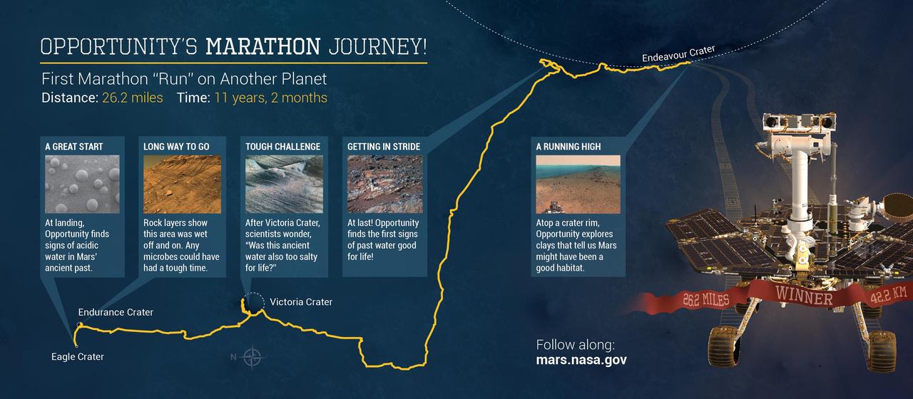
Opportunity Marathon Journey
2015-03-24 · NASA Image and Video Library
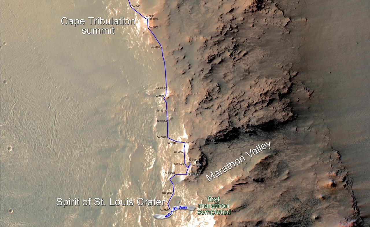
Opportunity Rover Surpasses Marathon Distance
2015-03-24 · NASA Image and Video Library
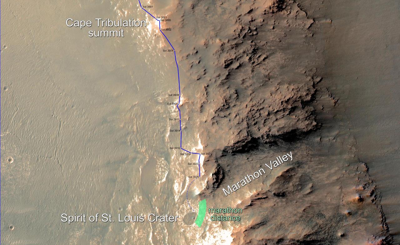
Opportunity Rover Nears Mars Marathon Feat
2015-02-10 · NASA Image and Video Library
Opportunity First Decade of Driving on Mars
2014-01-23 · NASA Image and Video Library
Opportunity Journey Exceeds 25 Miles
2014-07-28 · NASA Image and Video Library

Opportunity Journey, Approaching 10th Anniversary
2013-12-03 · NASA Image and Video Library
Opportunity Approach to Marathon Valley
2015-03-24 · NASA Image and Video Library
Opportunity Route to Endeavour Crater Wide View
2011-08-05 · NASA Image and Video Library