

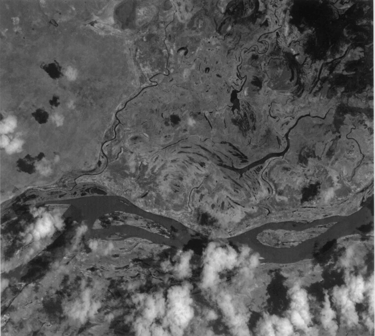
Dawson, Canada (ASTER)
Dawson, Canada was a boom town in 1898, with a population of 40,000. Discovery of gold in the Klondike fueled the massive influx of miners, merchants, and other support professions to this town on the Yukon River. The current population is just over 1,000, with over 60,000 tourists invading the town each summer. Shortly after gold discovery, large gold dredges began an industrial mining operation, leaving large tailings piles in their wake. These can be clearly seen along the creek east of Dawson. The image was acquired September 19, 2010, and is located at 64.1 degrees north latitude, 136.4 degrees west longitude.
- Date
- 2010-09-19
- Photographer / author
- NASA/METI/AIST/Japan Space Systems, and U.S./Japan ASTER Science Team
- Archive
- Wikimedia Commons
- Type
- photograph
- Original size
- 1,536 × 1,507 pixels
Public domainsafest
Reason: a NASA work: not copyrighted in the United States.
Read from: Commons licence category: PD NASA; no CC BY, CC BY-SA, GFDL or deletion tag on the file page.
Credit line
"Dawson, Canada (ASTER)" (2010-09-19). NASA/METI/AIST/Japan Space Systems, and U.S./Japan ASTER Science Team, via Wikimedia Commons. Public domain. https://commons.wikimedia.org/wiki/File:Dawson,_Canada_(ASTER).jpgNeed photos for a whole script? Add Find Any Photo to Claude and ask for this one by its id: 127814.
More like this

Norilsk, Siberia (ASTER)
2000-07-21 · Wikimedia Commons
Idaho Fires
2001-10-22 · NASA Image and Video Library

Coal Mining, Germany (ASTER)
2000-08-26 · Wikimedia Commons
Yellowstone Park
2002-10-15 · NASA Image and Video Library

Earth Observation
2014-06-23 · NASA Image and Video Library
California Solar Farms
2015-04-02 · NASA Image and Video Library
Lake Mead and Drought
2015-07-20 · NASA Image and Video Library
ASTER First Views of San Francisco River, Brazil - Visible/near Infrared VNIR Image monochrome
2000-03-11 · NASA Image and Video Library