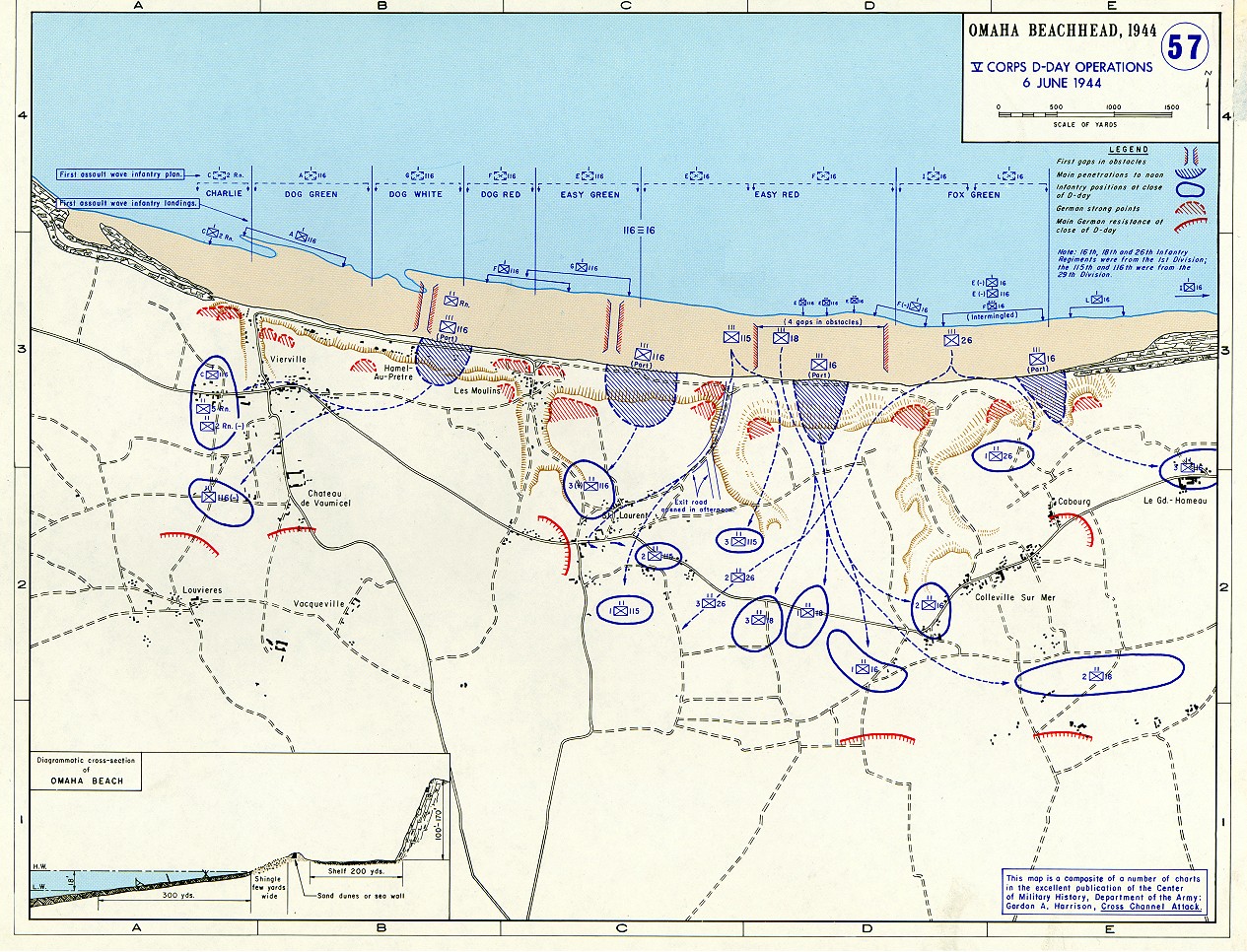

Omaha beachhead 6 June 1944
In 1938 the predecessors of what is today The Department of History at the United States Military Academy began developing a series of campaign atlases to aid in teaching cadets a course entitled, "History of the Military Art." Since then, the Department has produced over six atlases and more than one thousand maps, encompassing not only America’s wars but global conflicts as well. In keeping abreast with today's technology, the Department of History is providing these maps on the internet as part of the department's outreach program. The maps were created by the United States Military Academy’s Department of History and are the digital versions from the atlases printed by the United States Defense Printing Agency. We gratefully acknowledge the accomplishments of the department's former cartographer, Mr. Edward J. Krasnoborski, along with the works of our present cartographer, Mr. Frank Martini. Please be aware that these maps are large in file size and may require substantial download times
- Date
- 1944
- Photographer / author
- United States Military Academy’s Department of History
- Archive
- Wikimedia Commons
- Type
- map
- Original size
- 1,265 × 966 pixels
Public domainsafest
Reason: a US government work (US Army).
Read from: Commons licence category: PD US Army; no CC BY, CC BY-SA, GFDL or deletion tag on the file page.
Credit line
"Omaha beachhead 6 June 1944" (1944). United States Military Academy’s Department of History, via Wikimedia Commons. Public domain. https://commons.wikimedia.org/wiki/File:Omaha_beachhead_6_June_1944.jpgNeed photos for a whole script? Add Find Any Photo to Claude and ask for this one by its id: 1123.
More like this

Omaha Beach 1944 Second Assault
1945-09-20 · Wikimedia Commons

Omaha Beach 1944 Objectives
2007-09-06 · Wikimedia Commons

(June 6, 1944), HQ Twelfth Army Group situation map. 2004629028
1944-06-06 · Wikimedia Commons

Omaha beach east f 1944 2
1944-04-21 · Wikimedia Commons

Omaha beach west f4 1944
1944-04-21 · Wikimedia Commons

Omaha beach-aerial-view
1944-06-06 · Wikimedia Commons

Omaha 1944 Initial assault
1944 · Wikimedia Commons

Saint Lo and Vicinity
Wikimedia Commons