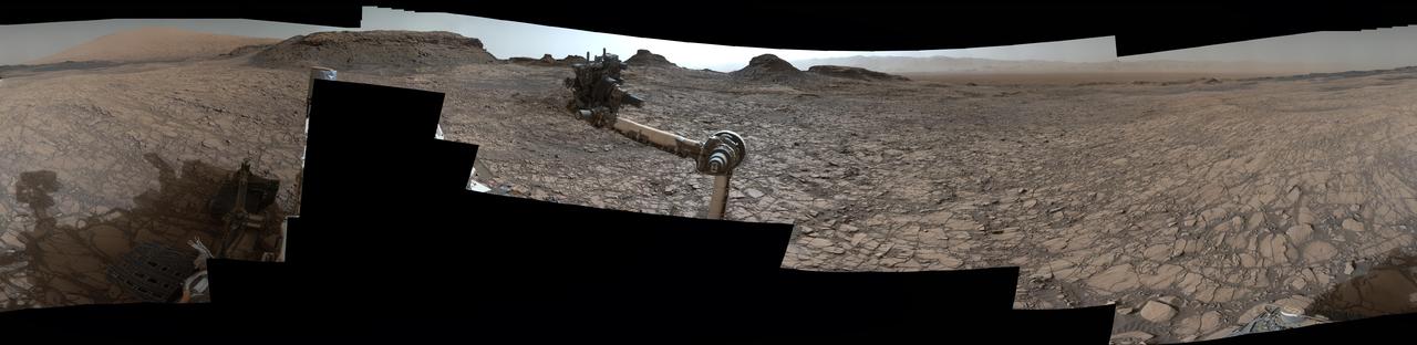
Rover Panorama of Entrance to Murray Buttes on Mars
This 360-degree panorama was acquired by the Mast Camera (Mastcam) on NASA's Curiosity Mars rover as the rover neared features called "Murray Buttes" on lower Mount Sharp. The view combines more than 130 images taken on Aug. 5, 2016, during the afternoon of the mission's 1,421st sol, or Martian day, by Mastcam's left-eye camera. This date also was the fourth anniversary of Curiosity's landing. The dark, flat-topped mesa seen to the left of Curiosity's robotic arm is about 300 feet (about 90 meters) from the rover's position. It stands about 50 feet (about 15 meters) high. The horizontal ledge near the top of the mesa is about 200 feet (about 60 meters) across. An upper portion of Mount Sharp appears on the distant horizon to the left of this mesa. The relatively flat foreground is part of a geological layer called the Murray formation, which formed from lakebed mud deposits. The buttes and mesas rising above this surface are eroded remnants of ancient sandstone that originated when winds deposited sand after lower Mount Sharp had formed. Curiosity closely examined that layer -- the Stimson formation -- during the first half of 2016 while crossing a feature called "Naukluft Plateau"
- Date
- 2016-08-19
- Photographer / author
- NASA/JPL-Caltech/MSSS
- Collection
- JPL
- Archive
- NASA Image and Video Library
- Type
- photograph
Public domainsafest
Reason: a NASA work: not copyrighted in the United States.
Read from: NASA media usage guidelines: NASA material is not copyrighted in the US unless noted; no third-party credit or mark found.
Credit line
"Rover Panorama of Entrance to Murray Buttes on Mars" (2016-08-19). NASA/JPL/NASA/JPL-Caltech/MSSS. Public domain. https://images.nasa.gov/details/PIA20765Need photos for a whole script? Add Find Any Photo to Claude and ask for this one by its id: 23328.
More like this
Rover Panorama Taken Amid Murray Buttes on Mars
2016-10-03 · NASA Image and Video Library

Wide 'Vera Rubin Ridge' Ahead of Curiosity Mars Rover
2017-07-11 · NASA Image and Video Library
Panorama from Curiosity Sol 1000 Location
2015-07-01 · NASA Image and Video Library
Crisp View from Inside Gale Crater
2012-08-09 · NASA Image and Video Library

Curiosity Mars Rover Approach to Pahrump Hills
2014-09-25 · NASA Image and Video Library

View Ahead After Curiosity Sol 376 Drive Using Autonomous Navigation
2013-08-27 · NASA Image and Video Library
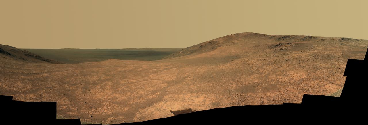
Mars Rover Opportunity Panorama of Marathon Valley
2016-06-14 · NASA Image and Video Library

Billion-Pixel View From Curiosity at Rock Nest, Raw Color
2013-06-19 · NASA Image and Video Library