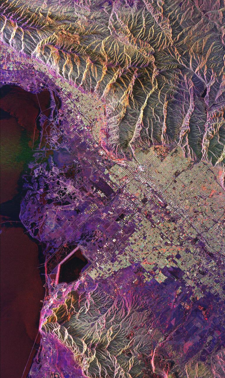
Space Radar Image of Salt Lake City, Utah
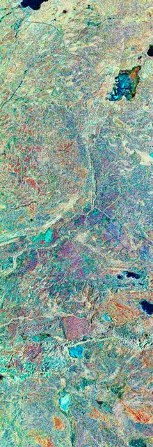
This radar image of Salt Lake City, Utah, illustrates the different land use patterns that are present in the Utah Valley. Salt Lake City lies between the shores of the Great Salt Lake (the dark area on the left side of the image) and the Wasatch Front Range (the mountains in the upper half of the image). The Salt Lake City area is of great interest to urban planners because of the combination of lake, valley and alpine environments that coexist in the region. Much of the southern shore of the Great Salt Lake is a waterfowl management area. The green grid pattern in the right center of the image is Salt Lake City and its surrounding communities. The Salt Lake City airport is visible as the brown rectangle near the center of the image. Interstate Highway 15 runs from the middle right edge to the upper left of the image. The bright white patch east of Interstate 15 is the downtown area, including Temple Square and the state capitol. The University of Utah campus is the yellowish area that lies at the base of the mountains, east of Temple Square. The large reservoir in the lower left center is a mine tailings pond. The semi-circular feature in the mountains at the bottom edge of the i
- Date
- 1999-04-15
- Photographer / author
- NASA/JPL
- Collection
- JPL
- Archive
- NASA Image and Video Library
- Type
- photograph
Public domainsafest
Reason: a NASA work: not copyrighted in the United States.
Read from: NASA media usage guidelines: NASA material is not copyrighted in the US unless noted; no third-party credit or mark found.
Credit line
"Space Radar Image of Salt Lake City, Utah" (1999-04-15). NASA/JPL/NASA/JPL. Public domain. https://images.nasa.gov/details/PIA01798Need photos for a whole script? Add Find Any Photo to Claude and ask for this one by its id: 90944.
More like this
Great Salt Lake, Utah, USA
1990-03-04 · NASA Image and Video Library
Great Salt Lake and Bonneville Salt Flats, UT, USA
1992-04-02 · NASA Image and Video Library
View of the Salt Lake City, Utah area
1973-08-30 · NASA Image and Video Library
Death Valley, California
1994-04-11 · NASA Image and Video Library
Space Radar Image of Sakura-Jima Volcano, Japan
1999-04-15 · NASA Image and Video Library
Space Radar Image of Colima Volcano, Jalisco, Mexico
1999-05-01 · NASA Image and Video Library
Earth Observations taken by Expedition 38 crewmember
2013-11-22 · NASA Image and Video Library
Three frequency false-color image of Prince Albert, Canada
1994-04-18 · NASA Image and Video Library