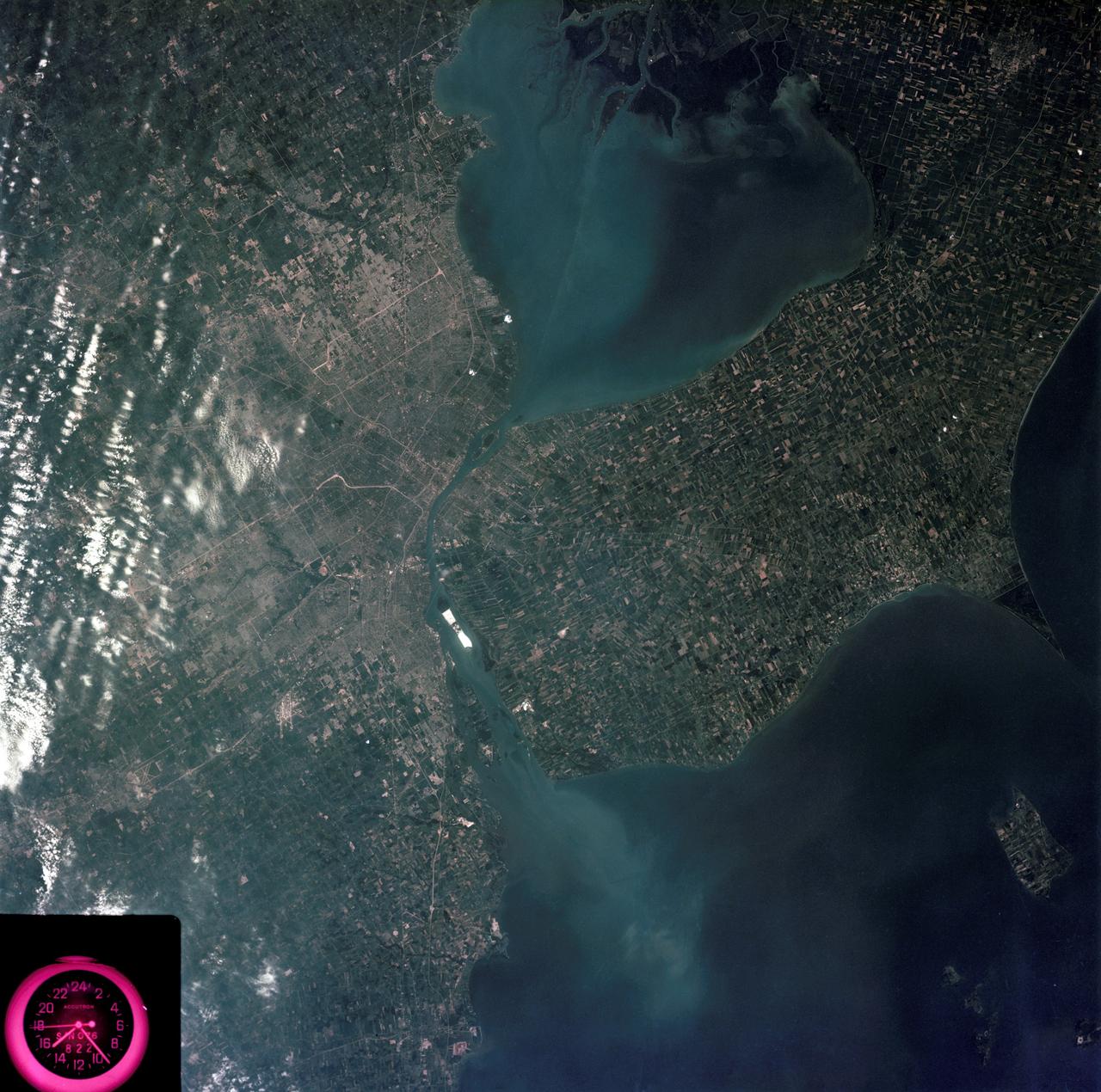
Detroit, Michigan metropolitan area photographed from Skylab
SL3-83-0152 (July-September 1973) --- A near vertical view of the metropolitan Detroit, Michigan area is seen in this Skylab 3 Earth Resources Experiments Package S190-B (five-inch Earth terrain camera) photograph taken from the Skylab space station in Earth orbit. The 25-mile long Detroit River drains the smaller body of water (Lake St. Clair) and flows southwestward separating Detroit from Windsor, Ontario, and empties into Lake Erie. The Detroit River handles a great deal of Great Lakes barge and ship traffic. Major streets and thoroughfares radiating from the city are clearly visible. Fighting Island is the highly reflective, white area located almost in the center of the picture. This high reflectivity is caused by the functional use of the island-disposal ponds for chemical salts. Sedimentation and/or pollution patterns in the area provide interesting visual phenomena for speculation and analysis. Distinct and rather unique cultivated field patterns can be observed south and east of Windsor, Ontario. This is a direct result of an English survey and land tenure system which was utilized when the area was settled. New areas of residential development are fairly easy to differen
- Date
- 1973-08-05
- Collection
- JSC
- Archive
- NASA Image and Video Library
- Type
- photograph
Public domainsafest
Reason: a NASA work: not copyrighted in the United States.
Read from: NASA media usage guidelines: NASA material is not copyrighted in the US unless noted; no third-party credit or mark found.
Credit line
"Detroit, Michigan metropolitan area photographed from Skylab" (1973-08-05). NASA/JSC. Public domain. https://images.nasa.gov/details/SL3-83-0152Need photos for a whole script? Add Find Any Photo to Claude and ask for this one by its id: 13856.
More like this

Detroit, MI, Toledo, OH and Lake Erie
1973-06-22 · NASA Image and Video Library
Detroit and the Lower Peninsula of Michigan
1973-06-22 · NASA Image and Video Library
View of Minneapolis-St.Paul, Minnesota area
1973-08-30 · NASA Image and Video Library
Washington, D.C. and the Baltimore, Maryland area
1973-08-15 · NASA Image and Video Library
View - Phoenix, AZ - Metropolitan Area - AZ
1973-08-15 · NASA Image and Video Library
View of southeastern New York State
1973-08-15 · NASA Image and Video Library
Metropolitan area of Chicago
1973-09-18 · NASA Image and Video Library
View of Lake Mead and Las Vegas, Nevada area from Sklyab
1973-08-01 · NASA Image and Video Library