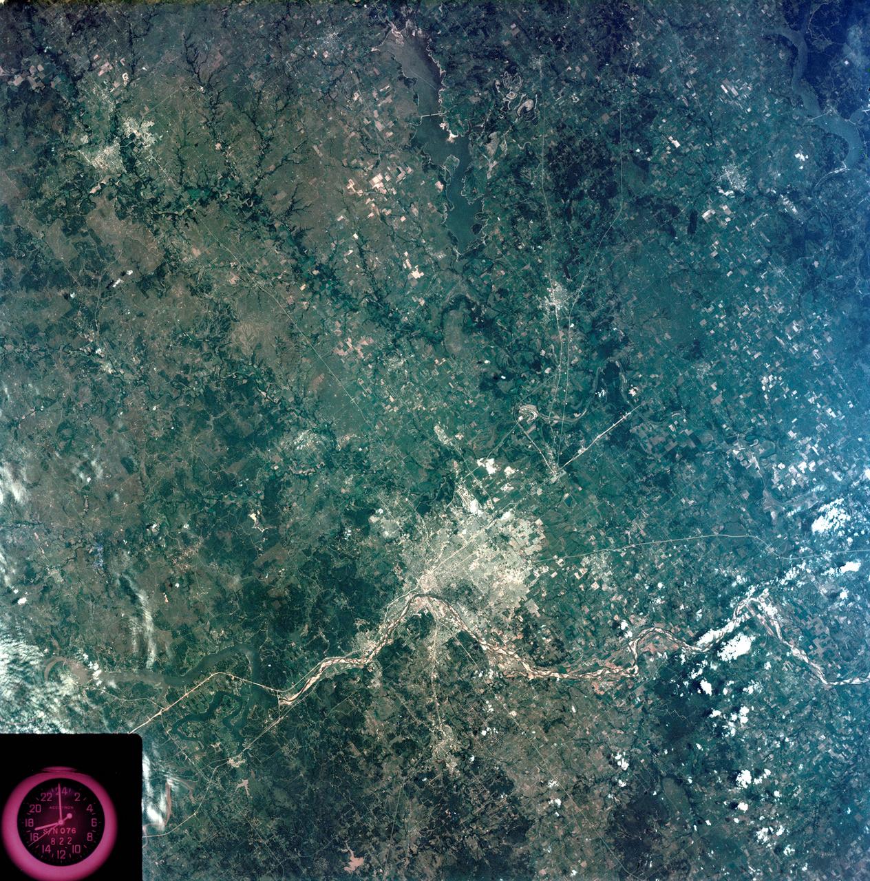
View - Northeast Oklahoma (OK) - Metropolitan Tulsa Area - OK
S73-35080 (July-September 1973) --- A vertical view of northeast Oklahoma and the metropolitan Tulsa area is seen in this Skylab 3 Earth Resources Experiments Package S190-B (five-inch Earth terrain camera) photograph taken from the Skylab space station in Earth orbit. THE PICTURE SHOULD BE HELD WITH THE CLOCK ON THE LEFT AND THE LAKE IN THE CORNER ON THE RIGHT. THE LONG STRETCH OF HIGHWAY (U.S. 75) RUNS STRAIGHT NORTH FROM TULSA. Tulsa, a rapidly expanding city in the heart of the mid-continent oil field, has a population of approximately 330,000. The Arkansas River meanders across the southern (lower) portion of the photograph passing through Tulsa as it flows southeastward. Oologah Reservoir, the long body of water, is located northeast of Tulsa. Lake Hudson is the body of water in the right corner of the picture. Keystone Reservoir is to the west and upstream from Tulsa. Westward from Tulsa U.S. 64 makes a 45 degree bend as it turns northwest to cross the Keystone Reservoir. The thin white line over the Oologah Reservoir is a highway bridge. Bartlesville is on U.S. 75 near the north (top) corner of the picture. The Tulsa International Airport is immediately northeast of downtow
- Date
- 1973-08-15
- Collection
- JSC
- Archive
- NASA Image and Video Library
- Type
- photograph
Public domainsafest
Reason: a NASA work: not copyrighted in the United States.
Read from: NASA media usage guidelines: NASA material is not copyrighted in the US unless noted; no third-party credit or mark found.
Credit line
"View - Northeast Oklahoma (OK) - Metropolitan Tulsa Area - OK" (1973-08-15). NASA/JSC. Public domain. https://images.nasa.gov/details/s73-35080Need photos for a whole script? Add Find Any Photo to Claude and ask for this one by its id: 13735.
More like this
View - Phoenix, AZ - Metropolitan Area - AZ
1973-08-15 · NASA Image and Video Library
Detroit, Michigan metropolitan area photographed from Skylab
1973-08-05 · NASA Image and Video Library
View of Tennessee, Virginia, Kentucky border area
1973-08-15 · NASA Image and Video Library
Slylab (SL)-3 View - North Central Wyoming (WY) - Southern Montana (MT)
1973-08-15 · NASA Image and Video Library
View of Minneapolis-St.Paul, Minnesota area
1973-08-30 · NASA Image and Video Library
Birmingham and central Alabama area seen in Earth Resources Exp. Package
1974-02-01 · NASA Image and Video Library
Oklahoma City, Canadian River, OK, USA
1991-05-06 · NASA Image and Video Library
View of Lake Mead and Las Vegas, Nevada area from Sklyab
1973-08-01 · NASA Image and Video Library